2020 Tropical Season Already a Record Breaker
Late last night the 2020 Hurricane Season earned a dubious distinction. It's the earliest a fifth storm has earned a name in the history of hurricane tracking. The previous record for the earliest named fifth storm was in the infamous hurricane season of 2005. You remember that season, right? It was the storm season that created the likes of Katrina and Rita
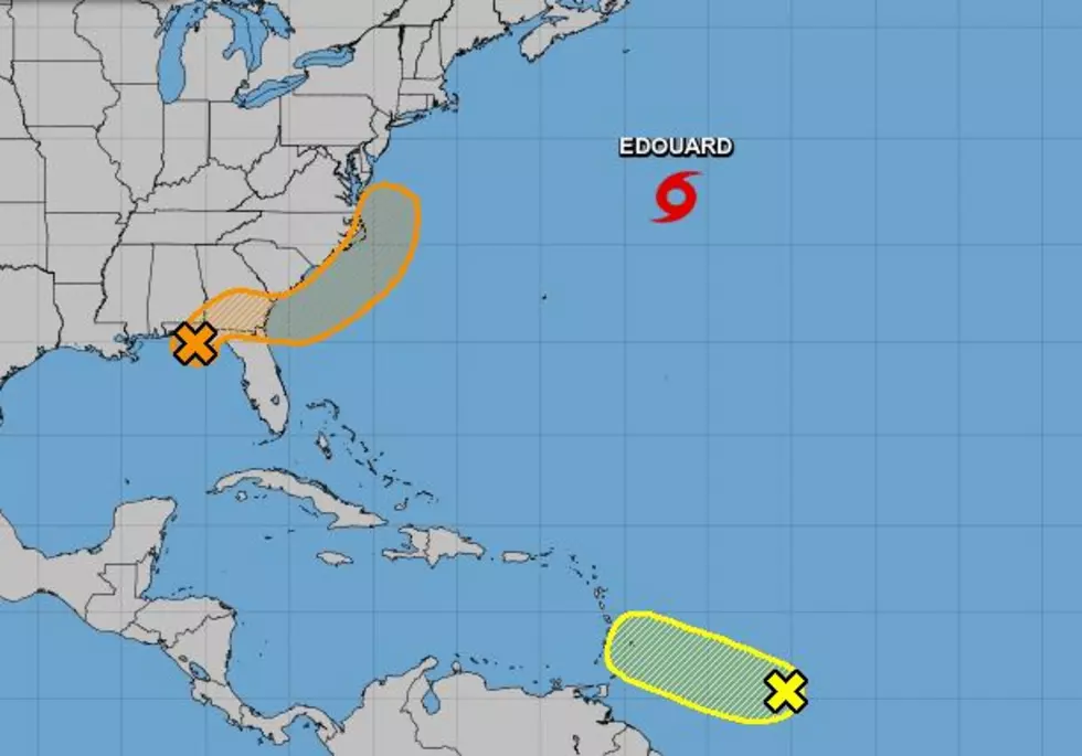
The good news about newly named Tropical Storm Edouard is that it is well out to sea in the North Atlantic and later today should become classified as post-tropical as it moves to the northeast away from the island of Bermuda.
Meanwhile, the tropics are very active in two other spots. One is well out in the Atlantic about 650 miles east of the Windward Islands. The system is expected to drift slowly to the west and could affect the Lesser Antilles by Tuesday. However, a significant strengthening of this system is not forecast over the next several days.
Closer to home forecasters are watching a broad area of low pressure that is centered along the Florida coast between Panama City and Appalachicola. There are some showers and thunderstorms associated with this system but forecasters do not anticipate this system to strengthen in the Gulf of Mexico.
However, there is the potential the system could get stronger once it crosses South Georgia and Northern Florida and emerges into the waters of the Atlantic Ocean off of Savannah or Jacksonville. The system is expected to sweep up the east coast of the United States bringing with it a chance for heavy rains and gusty winds.
8 Reasons Why Mosquitoes Love You More Than Other People
More From Highway 98.9


![Hurricane Laura Timeline, Storm Surge Info, Wind Speeds and More [Video]](http://townsquare.media/site/180/files/2020/08/Screenshot_261.jpg?w=980&q=75)