Threat of Heavy Rains Has Shreveport Under Flood Watch
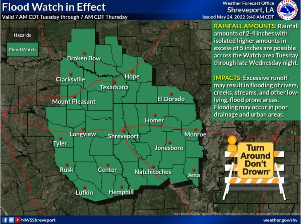
The National Weather Service in Shreveport has issued a Flood Watch from 7:00 am today, May 24, through 7:00 am this Thursday, May 26.
The Flood Watch is for the entire Four State Region which includes Northwest Louisiana, Northeast Texas, Southwest Arkansas and Southeast Oklahoma.
The crux of the watch is the threat of heavy rainfall with localized flooding which has the potential to increase tonight through late Wednesday night.
NWS forecasters are estimating we could see rainfall amounts ranging from two to four inches with isolated higher amounts in excess of five inches in some areas.
Excessive runoff from these storms could result in the flooding of rivers, creeks, streams, and other low-lying, flood-prone areas. Flooding may occur in poor drainage and urban areas.
The National Weather Service is forecasting that we'll see a few rounds of strong to potentially severe thunderstorms later this afternoon and well into tonight. Any severe storms will have the capability of producing severe hail and damaging winds.
They also remind us that a tornado cannot be ruled out.
The 10 People or Apps Shreveport Trusts Most For the Weather
Shreveport/Bossier's Ultimate Favorites For Fried Fish
More From Highway 98.9